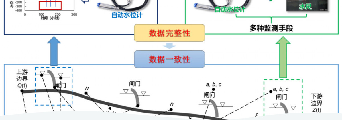
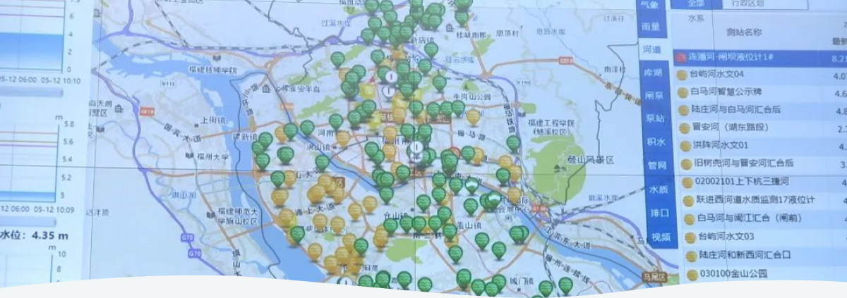
GWP China technical team supported the Fuzhou city to set up an AI based flood control system "Water Intelligent System" (WIS). With total investments over 8.5 million EUR, China’s first urban flood control system covers 1000 reservoirs, lakes, pools, rivers, gates, stations and underground rainwater and sewage pipelines, 500 kilometers of riverside footpaths, 376 pearl parks, 598 street parks and 15 large-scale ecological parks. WIS tools working as the "eyes, brain and hands" of decision-makers facilitate the transition to smart flood control and digital water management in Fuzhou.
Fuzhou, a capital city of Fujian province, is located on the west coast of the strait challenged by typhoons and local short-lived heavy rainfall. In a low-lying submergence area, this city is circled with mountains in three sides and the left side is to the sea. The upstream mountain area of Fuzhou is threatened by the flood, the midstream has no space for urban water storage and the downstream is affected by the tidal level of the Min River.
As for the urban infrastructure, Fuzhou has weak flood discharge capacity, thus being fragile to heavy rainstorm due to limited flood control and drainage facilities. City's inner river is connected with Min River in turn impacted by tidal movements of the East China Sea and upstream hydropower stations with limited output capacity and delayed water diversion from pumping stations.
Fuzhou's urban water management lacked an integrated urban flood monitoring system. Municipality used to take water project scheduling decisions on sectoral basis, since various sectors (such as inland rivers, water supply and drainage, urban reservoirs and pumping stations along the river gates, as well as inland river landscape environment) were managed by different authorities not collaborating with each other.
Fuzhou WIS is China’s first urban water system upon digital information and MSP platform. In cooperation with the urban and rural development authorities managing the water sector and meteorology, GWP China technical team and IWRM experts supported the Fuzhou city to create a digital flood control system by employing innovative information technologies e.g., big data analysis and AI to help the city achieve digital empowerment, pollution control and carbon reduction.
The system covers 500 km of riverside footpaths, 376 pearl parks, 598 Street parks and 15 large-scale ecological parks. GWP China and IWRM experts supported product development and conducted capacity building sessions on smart management of urban flooding, river management and other water issues in Fujian Province since early 2020. Fuzhou city being the pilot project has started developing the system since late 2020. Fuzhou Water Intelligent System recently won the 2021 World Smart City Award on April 15, 2021.
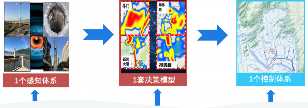
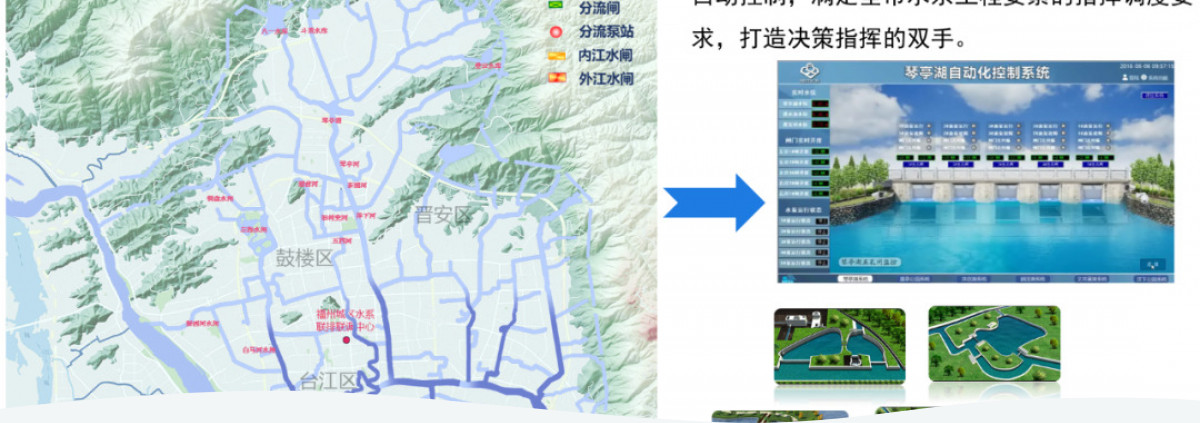
The system has so-called "eyes, brain and hands". Using digital and integrated flood control, its "eyes" use perceptual monitoring and early warning; its "brain" provides automatic and scientific decision-making on flood management and control scenarios; and “hands” work through the integrated practice of three response scenarios - urban emergency waterlogging prevention, multi water movement in inland rivers and integrated management of power plants and rivers. Daily operations of WIS cover at least 1000 water reservoirs, lakes, pools, rivers, gates, stations, underground rainwater and sewage pipelines. The WIS system as a platform ensures collaboration among the water, urban and rural development authorities, environment and meteorology services who work together on the smart platform to make prompt and quick response to heavy rainfall, typhoons and other extreme climate issues.
A recent example of flood response clearly illustrates the benefits of digital flood management. On April 27th, 2022, Fuzhou was threatened by heavy rainfalls that challenged its drainage and flood prevention capacity. In the afternoon of April 26th, after receiving the early alert signals issued by the Municipal Meteorological Administration, WIS monitoring center informed water and urban management authorities to empty, discharge and vacate storage stations ahead of the disaster to keep water level under the urban flood warning standard. At 4:00 am on April 27th, the system forecasted potential flooding spots which were communicated to the flood response teams. Same day, as soon as the rainfall met the high-water level, the monitoring system collected further information and provided updated forecast to the related departments within the urban flood control headquarters.
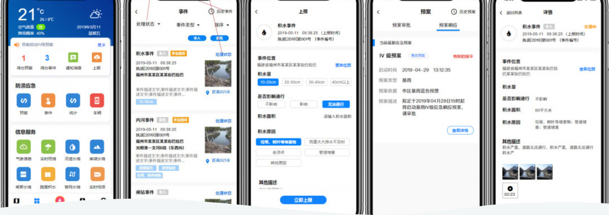
Responders at flooding sites could use drainage equipment and work together with other authorities at all levels via "Dragon Suction" mobile application. WIS provided each sector with forecasts, updated data and recommendations for the meteorological and traffic police departments. The system analysed multiple scenarios depending on the stakeholder mandates to protect communities from heavy rainfalls within 24 hours after the flood alarm.
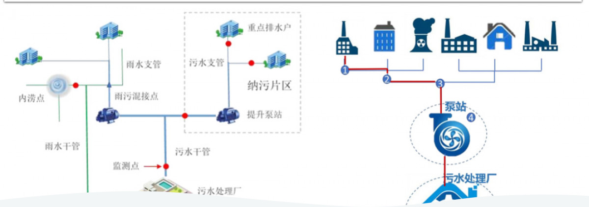
Water Intelligent System received investments amounting to more than 8.52 million euros that helped creating 266 hm² green areas along the urban rivers and increasing surface water space by 80+ hm² which alleviates the heat island effect in Fuzhou. Implemented activities basically adapted the nature-based solution, as the system employs natural tidal energy to replace the high energy consumption diversion pump station, saving 36.67 million kWh of electricity every year (equivalent to reducing 29,000 tons of carbon dioxide emissions per year). The system optimizes the efficiency of sewage concentration and sewage collection rate of the sewage plant, control over energy consumption for pollutant removal, and reduces carbon dioxide emissions by 2700 tons each year. The remarkable outcomes of WIS implementation attracted over 100 municipalities and cities to visit and learn.
Integrated nature of the Fuzhou flood control system in Fuzhou manifests through involvement of all related governmental agencies having a mandate in flood and water management in decision-making and flood response instead of former fragmented and uncoordinated action. The system can detect the risks accurately and provide intelligent early warning. Based on the grid results of short-impending and short-term weather forecast, the forecasting system creates real-time simulation model of urban flooding process, predicts and detects risks for urban river flow and waterlogging. The decision support platform links potential scenarios of response by personnel, machinery and other tools through creating a common map to monitor information from various sources under real-time command scenarios. It incorporates all water resources, including lakes, rivers, locks, pumps, networks and plants. The Coordinated Drainage and Dispatching Center then convenes Municipal Construction Committee, Water Resources Bureau, Urban Management Committee and other water-related authorities to develop one common workplan to share river and water information and improve the level of scheduling management towards integrated joint scheduling and regulation or multi-water unity, network-plant-river integration.
The multi-stakeholder nature of the WIS development stage played a fundamental role for its outcomes. Joint efforts of the water authorities, river basin agencies, provinces and construction departments proved to be essential to design an efficient and innovative digital flood control system which monitors now half of the total water consumption.
Real-time and updated data gathered from several sources along the water body is essential to bridge scientific approaches with realistic response capacities of mandated agencies. It allows to create a decision support system which uses raw data to model potential scenarios as the situation develops and new risks emerge.
 Case studies