Tool -
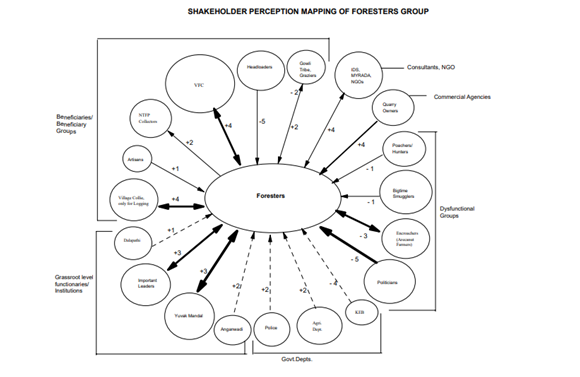
Institutional mapping is a visual method of identifying key institutions, illustrating their relationships, and specifying the respective function they play within a specific sector or area of governance. Institutional mapping provides an overview of the power structure and its influence given a specific issue, geographic and legal boundaries of governance, how governance relates to human activities, and insight into the social hierarchy. Institutional maps typically illustrate the following key structural features:
-
Institutions: these are the formal and informal stakeholder groups and organisations that play a role within a specific area of governance (e.g., ministries and governmental offices, civil society organisations, private actors, etc.)
-
Roles and Functions: several different functions are performed under a specific area of governance. Such function can include for instance informing, consulting, authorizing, financing, operating, regulation, etc. An institutional map must specify what are the roles played by each institution that is depicted within the institutional map.
-
Relations: institutional maps are not only about understanding “who does what”, it is also about identifying “how institutions relate to each other”. Whether an institution reports to another is a critical feature that needs to be depicted in an institutional map. You can also use an institutional map to characterise whether institutions have a positive or adverse relationship and how strong that relationship is.
-
Boundaries: in certain sectors decisions are made at various levels (municipal, watershed, regional, national, regional, etc.). Maps should illustrate where actors situate themselves across those geographic boundaries of governance.
Figure 1 below provides an example of an institutional map highlighting these main structural elements.

Figure 1. Institutional Map of Water Resources Management in Cape Town, South Africa (Source: OECD, 2021)